
Temperate Cyclones / Extra-Tropical Cyclones / Mid-latitude Cyclones / Frontal Cyclones / Wave Cyclones

Cyclones that develop beyond the tropics are known as temperate cyclones. They develop between 35° and 65° latitudes in the northern and southern hemispheres (Fig: 1) and for this reason, they are called mid-latitude, temperate or extra-tropical cyclones. These three names tell us about the latitudinal location of these cyclones.
While frontal and wave suggest the mechanisms of these cyclones. We will read more on this below.
Polar front theory
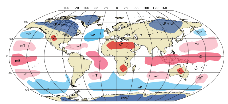
This theory tries to explain the functioning of temperate cyclones. According to this theory, warm and humid air from lower latitudes meets cold and dry air from higher latitudes or poles and forms a front as these two air masses don’t mix readily. Such a front formation is usually found between subtropical high and sub-polar low-pressure belts (Fig: 2) or between 35° and 65° latitudes.
Read more about ‘Air Masses’ & ‘Air Fronts’
Mechanism of a temperate cyclone

The cyclonic circulation leads to a well-developed extratropical cyclone, with a warm front and a cold front.
• Warm air pockets, known as the warm sector, are wedged between the advancing cold air and the rear cold air. The warm air moves over the cold air, causing a sequence of clouds to form over the sky in front of the warm front and leading to precipitation.
• The cold front approaches the warm air from behind and pushes the warm air up. The result of this is the development of cumulus clouds along the cold front. The cold front moves faster than the warm front, eventually overtaking it. The warm air is then fully lifted, causing the front to occlude and leading to the dissipation of the cyclone.
• The surface and aloft wind circulations are closely connected.
• Therefore, a temperate cyclone is characterized by intense frontogenesis, mainly of the occlusion type.
Warm air from near the equator moves towards the north while cold air from the poles moves towards the equator or south (Fig. 4) and forms a front when it pushes against each other (Fig. 5 & 6).
Gradually pressure on the front drops and the warm air starts moving north and the cold air moves south. This moving air under the influence of Coriolis force is deflected towards the right in the northern hemisphere resulting in an anti-clockwise cyclonic circulation (Fig. 7). This cyclone circulation leads to a well-developed temperate or extratropical cyclone and advances in the influence of jet streams.
Weather map symbols:
1. cold front
2. warm front
3. stationary front
4. occluded front
5. surface trough
6. squall/shear line
7. dry line
8. tropical wave
9. trowal
Depending on the direction of movement of air masses different fronts are formed. Figure 8 shows different weather fronts. These fronts are represented by different shapes and colours.
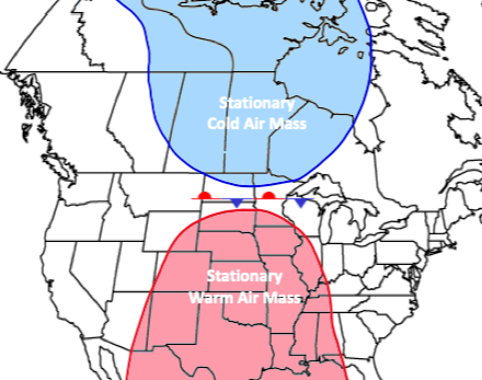
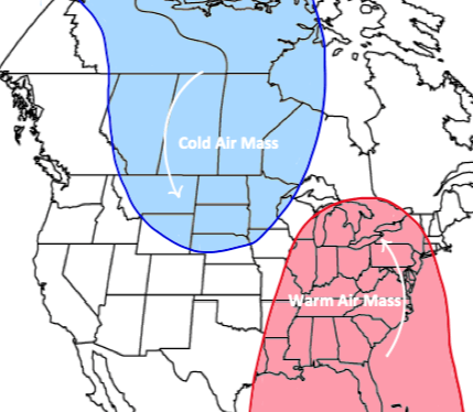
The air behind the warm front is warm and pushes the stationary cold air mass [Figure 9(a)].
The air behind the cold front is cold and pushes the stationary warm air mass [Figure 9(b)].
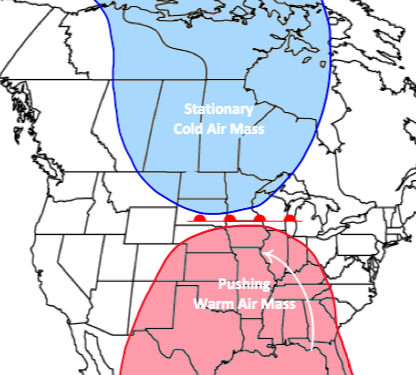
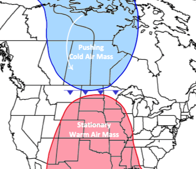
Figure 9(c) represents a condition when both air masses become stationary. Such a front is known as a stationary front.
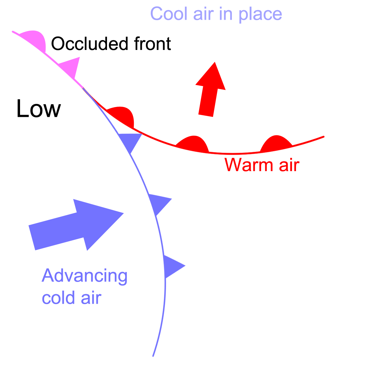
Occluded Front: It is the last front or we can say the last stage of a temperate cyclone. When the lighter warm air is finally lifted up against the heavier cold air, the cyclone dissipates, thus forming an occluded front.
Different weather conditions prevail when different air masses interact with each other. To understand the weather conditions associated with the respective movement of air masses it’s important to have a look at the cross-section of these fronts. Read more about Air Fronts…